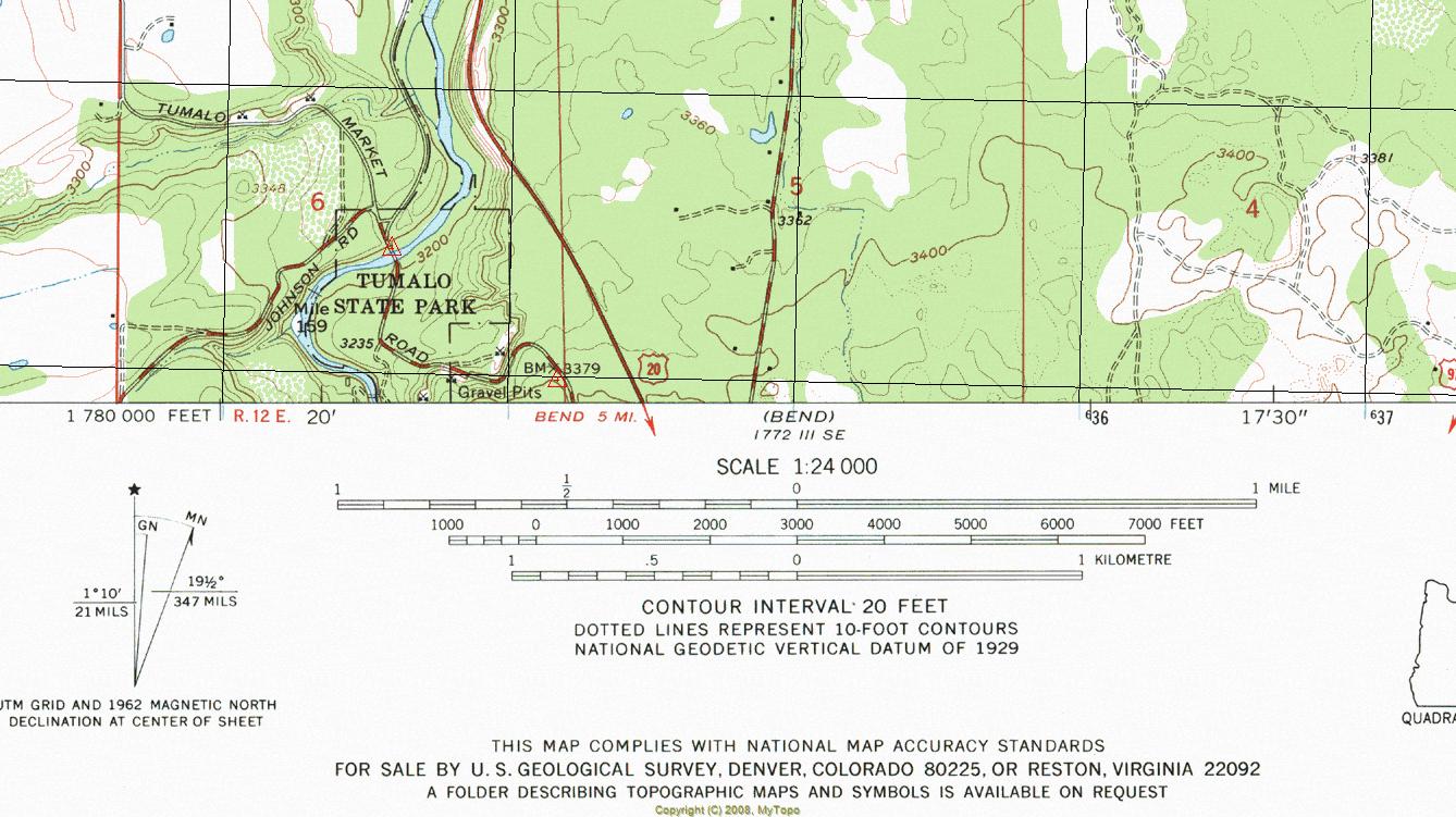
Map scale is a fundamental concept in cartography that plays a crucial role in how we interpret and navigate through geographic information. It refers to the relationship between distance on a map and the corresponding distance on the ground. Understanding map scales can significantly enhance our ability to read maps accurately, plan routes, and appreciate the geography of the areas we are exploring. Whether you are a seasoned traveler, a student, or simply someone interested in geography, grasping the concept of map scale is essential for accurate navigation and spatial awareness.
When you look at a map, you may notice that it includes a scale bar or a numerical ratio. This is where the magic of map scale comes into play, allowing you to convert map measurements into real-world distances. For instance, a map scale of 1:50,000 means that one unit of measurement on the map (like an inch or centimeter) equals 50,000 of the same units in reality. Understanding this relationship can help you gauge distances, estimate travel times, and even evaluate the size of features like mountains, rivers, and cities.
Moreover, map scales come in various forms, such as graphic scales, verbal scales, and fractional scales. Each type has its unique advantages and applications. By learning how to interpret different map scales, you can become a more proficient map reader, allowing you to navigate new territories with confidence. In this article, we will explore the intricacies of map scale, its types, and its practical applications in everyday life.
What is Map Scale and Why is it Important?
The concept of map scale is essential for various reasons. Firstly, it helps users understand the proportionality of the map’s representation of the real world. Without a clear understanding of map scale, one could easily misinterpret distances, leading to confusion and potential navigation errors. Secondly, map scale allows for effective planning, whether for travel, hiking, or urban development.
How is Map Scale Measured?
Map scale can be measured in several ways, including:
- Fractional Scale: This is expressed as a ratio, such as 1:100,000, indicating that 1 unit on the map equals 100,000 units in reality.
- Graphic Scale: Also known as a scale bar, this visually represents distances on the map, allowing users to measure distances directly.
- Verbal Scale: This is a written description, like “1 inch equals 1 mile,” which conveys the scale in words.
What Types of Map Scales Exist?
Understanding the different types of map scales can greatly enhance your mapping skills. Here are the most common types:
1. Large Scale Maps
Large scale maps show a smaller area in greater detail. They are typically used for city planning, hiking trails, and detailed navigational purposes. Examples include:
- City maps
- Topographic maps
- Tourist maps
2. Small Scale Maps
Conversely, small scale maps cover larger areas with less detail. They are useful for understanding broader geographical contexts, such as:
- World maps
- Regional maps
- Political maps
How to Convert Map Scale Measurements?
Converting measurements from a map scale to real-world distances is straightforward once you understand the scale type. Here’s a step-by-step guide:
- Identify the scale of the map (e.g., 1:50,000).
- Measure the distance on the map using a ruler.
- Multiply the measured distance by the scale factor (e.g., if the map distance is 2 inches, then 2 x 50,000 = 100,000 inches in reality).
- Convert the real-world distance into a more manageable unit if necessary (e.g., miles or kilometers).
What Are Common Mistakes When Interpreting Map Scale?
Even experienced map readers can make mistakes when interpreting map scale. Here are some common pitfalls:
- Misunderstanding the scale type (e.g., confusing large scale with small scale).
- Neglecting to convert units (e.g., mixing feet and meters).
- Assuming that distances are the same on all map scales.
How Do Different Regions Affect Map Scale?
Different geographical regions may require different map scales. For example, urban areas may benefit from large scale maps to provide detail on streets and buildings, while rural areas may use small scale maps to depict broader landscapes. Additionally, mountainous regions may need topographic maps that use specific scales to represent elevation changes accurately.
How to Use Map Scale in Real Life?
Understanding map scale can significantly improve your ability to navigate in real-life scenarios. Here are some practical applications:
- Planning road trips or hiking routes.
- Participating in urban planning or development projects.
- Studying environmental changes or geographical features.
Conclusion: The Importance of Mastering Map Scale
In conclusion, grasping the concept of map scale is vital for anyone who interacts with maps, from casual users to professional cartographers. By understanding the different types of map scales, how to measure them, and their applications, you can enhance your navigational skills and overall appreciation for geography. Whether you're planning a journey, studying landscapes, or engaging in urban development, a solid understanding of map scale will serve you well in your endeavors.
Article Recommendations
- Alexis Ayalas Love Life Who Is His Wife
- Nick Mullens Contract Details Latest News
- Rex Ryanrsquos Impact On The Buffalo Bills A Detailed Analysis


